This post is also available in:
Several things have been known about mountain hiking for years: Firstly, hiking/mountaineering is the most popular activity in the mountains among locals and vacationers. Secondly, it is the mountain sport discipline with the highest number of fatalities (106 on average in Austria, followed by piste/ski route with 29 fatalities). Thirdly, it is also the alpine sport with the most different levels of difficulty – not only in the different Alpine nations, no, even within Austria, for example, there are different official classifications depending on the federal state, which do not go beyond the national border. Even experts lose track here and have just as little overview as the mountain hikers themselves. The good news: as part of the ongoing Interreg project DIGIWAY, numerous different trail classifications have – finally – been studied, compared and contrasted in a transnational and neutral manner. Not to reinvent anything, but to present the current situation and to develop a practical proposal for an objective and fact-based comparison for all user groups. Walter Würtl and Peter Plattner report on behalf of the project team.
Walter Würtl
Alpine scientist,
Expert, mountain guide
Peter Plattner
Specialist author, expert,
mountain guide
“DIGIWAY – Geodata for Safety in the Mountains” is an Interreg project in which a working group under the leadership of the Province of Tyrol (Forestry/Landscape Service Group, Sports Department) has carried out a comparison of trail classifications and developed a system for assessing technical difficulty and danger (consequences). The content was developed by Lucia Felbauer, Klaus Pietersteiner, Christoph Kovacs, Christoph Höbenreich (all from the Province of Tyrol) and Walter Würtl and Peter Plattner (LO.LA Peak Solutions GmbH).
More about this project at europaregion.info.
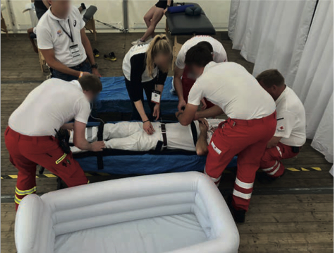
Looking at the ÖKAS accident statistics – still under the impression of the series of fatal accidents on Austria’s hiking trails in spring and at the beginning of summer 2025 – it quickly becomes clear where measures for alpine accident prevention could be implemented most effectively or are urgently needed. Of the 303 alpine fatalities in the last observation period (01.11.2023 to 31.10.2024), 120 died while hiking: 40 percent due to cardiovascular disorders, 26 percent due to falling/stumbling/slipping and 24 percent fell fatally.
When it comes to so-called accident analyses, people are quick to talk about a lack of ability, poor preparation and a lack of personal responsibility. This is true, but it is difficult to take these points into account when planning a tour if there are no standardized and consistent assessments for hiking and mountain trails and/or if it is not possible to fall back on the reliable assessments of the trail owners when planning.
In practice, you have to rely on the more or less accurate assessments in tour platforms – or in the guide literature – both in terms of the route (geometry of the route) and the route classification (classification of difficulty classes).
However, if neither the expected requirements with their difficulties (probability of occurrence) nor the possible consequences (extent of damage) are well communicated, no risk (probability of occurrence x extent of damage) can be determined in the planning. Nobody can then expect a hiker to take responsibility for their own actions. Because personal responsibility can only be assumed by someone who knows what they are letting themselves in for!
An (almost) Babylonian confusion of languages
In fact, it is hard to believe that there are no generally valid classifications or difficulty ratings in the field of hiking and mountaineering. What is completely self-evident in climbing or via ferrata, namely that there are objective, generally applied and comparable rating systems, is an unmanageable patchwork with more or less regional validity in hiking and mountaineering. There are official (official) classifications on a legal basis as well as classifications from alpine associations, recommendations from tourist regions or “self-created” ratings in the various tour portals.
The quality is quite variable and ranges from very differentiated and complex systems to often completely unsuitable attempts to bring some structure into the tour offer. In this context, “complex” is not synonymous with understandable and good!
The truth is that even experienced hikers and mountaineers often get confused when trying to find their way through the multitude of classifications on offer. No wonder, because designations, symbols and color codes are not standardized and the same hiking or mountain trail is presented and described completely differently depending on the region, development, originator or marketing strategy. This Babylonian linguistic confusion ensures that even well-intentioned warnings and recommendations remain unclear or misleading.
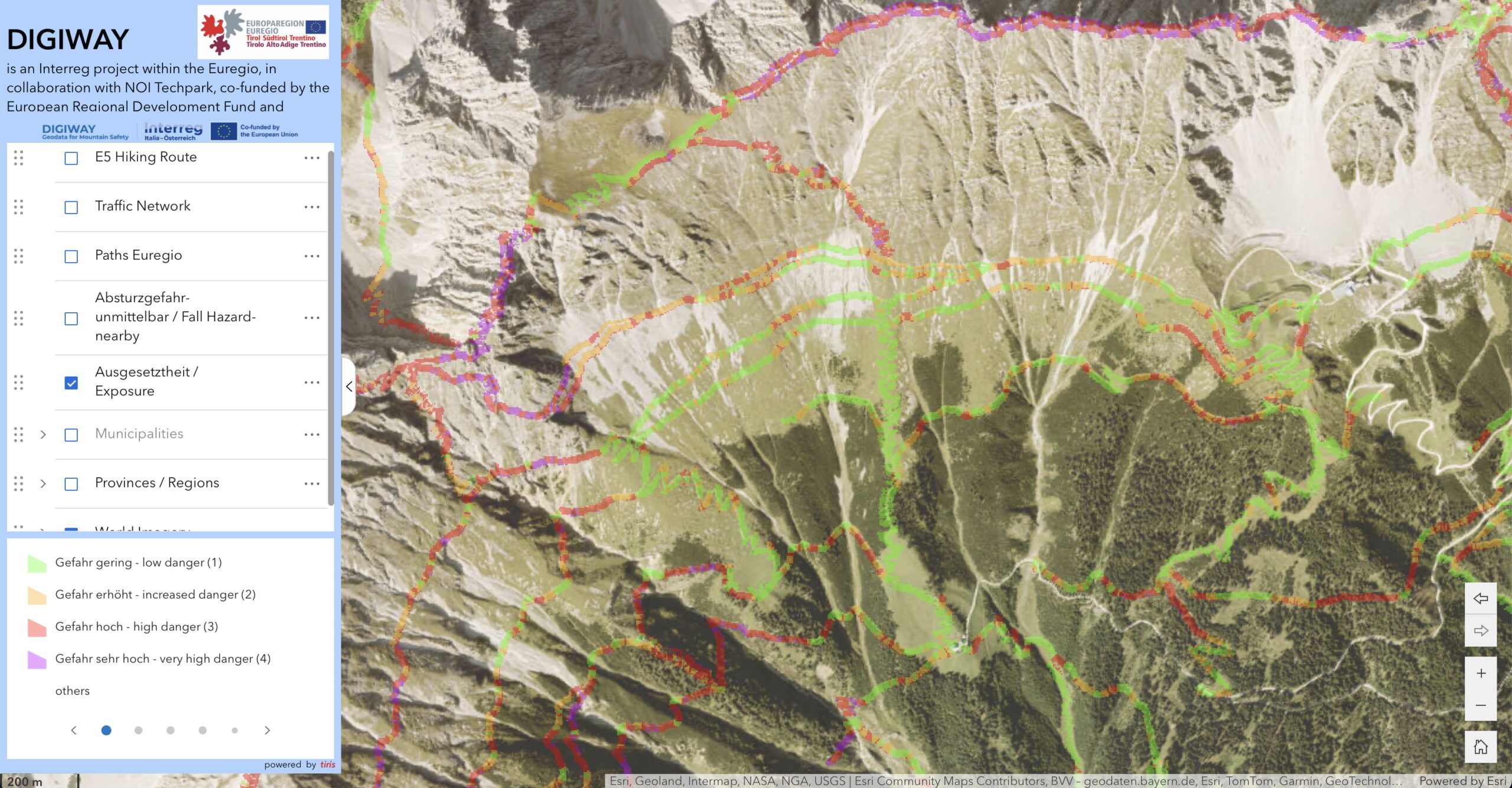
“As early as 1984, the Tyrolean provincial government adopted the first guideline for the difficulty classification of the alpine trail network and the introduction of the Tyrolean mountain trail quality seal. Building on this, the Tyrolean hiking and mountain trail concept was issued in 2000. Its simplicity and clarity have proven their worth. In 2020, the province of Tyrol initiated the innovative risk assessment tool RAGNAR. In order to further raise awareness of the requirements and dangers on mountain trails and make them comparable across borders, the province of Tyrol initiated the Euregio project DIGIWAY in 2024/25 and implemented it under the leadership of the system partners and with the support of experts. The comparative system developed in the process and the exposure and fall consequences map are a further milestone originating from Tyrol as a planning aid and for increasing safety in mountain hiking.”
Christoph Höbenreich, mountain sports expert at the Office of the Tyrolean Provincial Government, Sports Department
The comparison table